
Below are maps of the whole of Palestine, the Gaza Strip, and the West Bank, along with a little context. For more information about Palestine, see Everything I Wish I Could Pin on Twitter, A Timeline of the Colonization of Palestine, or the links at the bottom of this page.
Map of Palestine
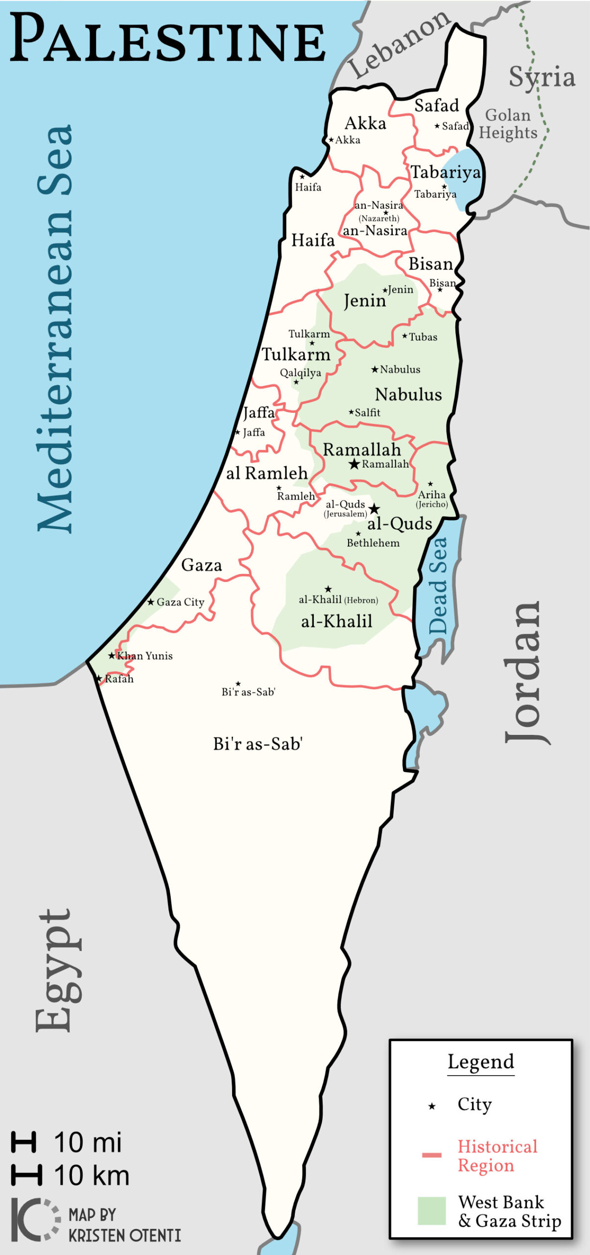
The State of Palestine, showing the regions as of 1946, before Israel started stealing land en masse.
While the area was then known as Canaan, Philistines first arrived in 1267 BCE. By the 5th century BCE, the region was called Palestine. It wasn’t until 136 CE that Jewish people were banished from the region—by Roman emperor Hadrian.
After centuries of various empires occupying Palestine, Britain terminated their mandate in 1948 and transferred their rule to Zionists, who’d been hoping to colonize Palestine since 1897. Al-Nakba (The Catastrophe) is recognized every year on May 15, the day Israel came to be.
Map of Gaza Strip
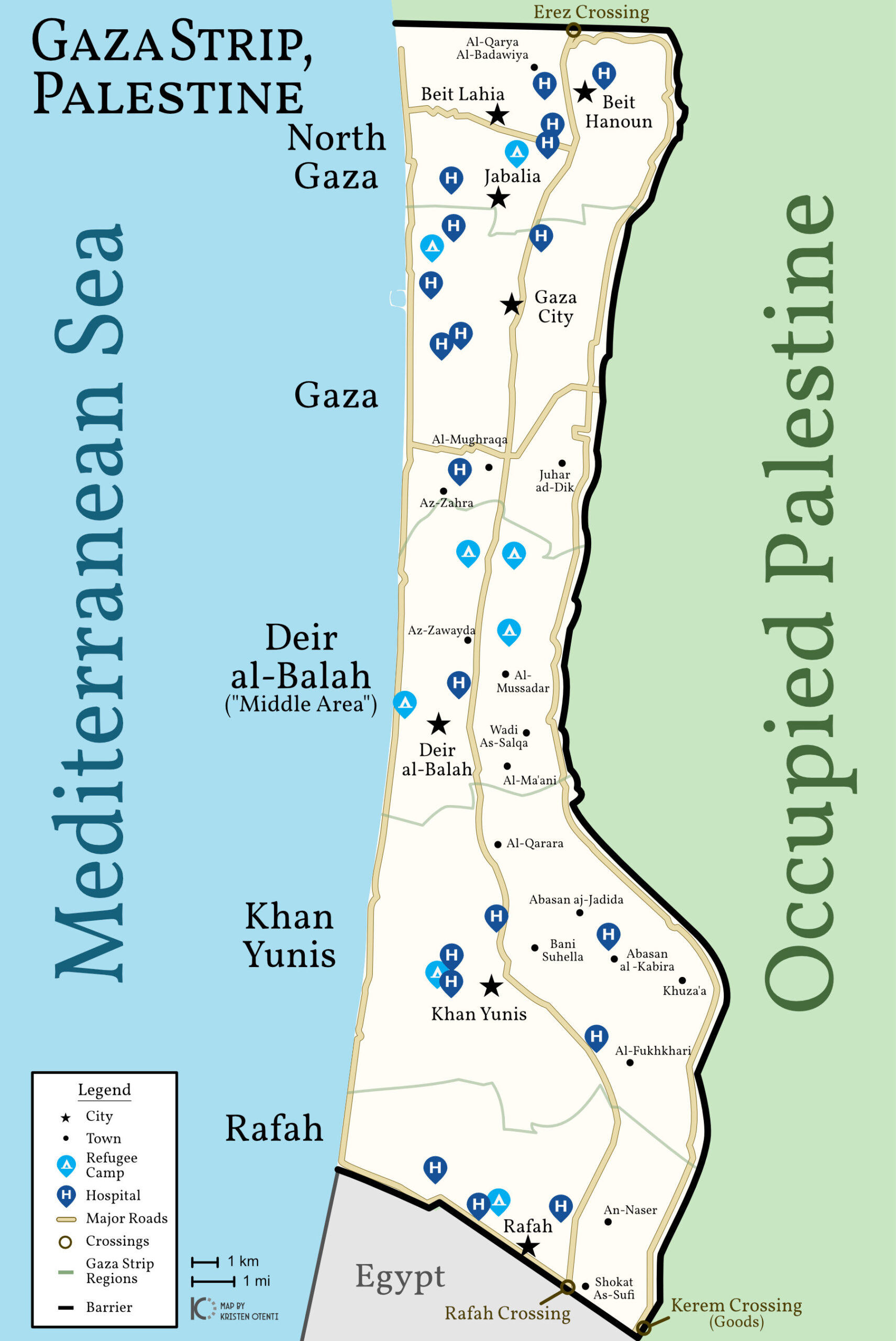
The Nakba forced Palestinians from across Palestine either into present-day Gaza Strip and West Bank areas, or to flee the country altogether. Israel began to establish laws transferring Palestinian property to Jewish folks immigrating from all over the world. After the Six-Day War in 1967, Israel imposed martial law on the Gaza and West Bank.
The current Gaza Strip, a fraction of the size of the Gaza region of Palestine, is enclosed with a barrier—part wall, part fence—that Israel not only controls access through but also patrols to ensure Palestinians trapped inside don’t escape.
In the four months of extreme hostility since October 7th, Israel has been forcing Palestinians in Gaza southward, claiming Rafah is the safe area. If you notice on the map, though, being forced south into Rafah forces these Palestinians literally against a wall.
There has also been talk of closing the Rafah crossing—through which Palestinians have been allowed into Egypt, provided they have enough bribe money—and combining it with the goods-only Kerem Crossing, thereby increasing Israel’s control of Palestinian people.
Map of West Bank
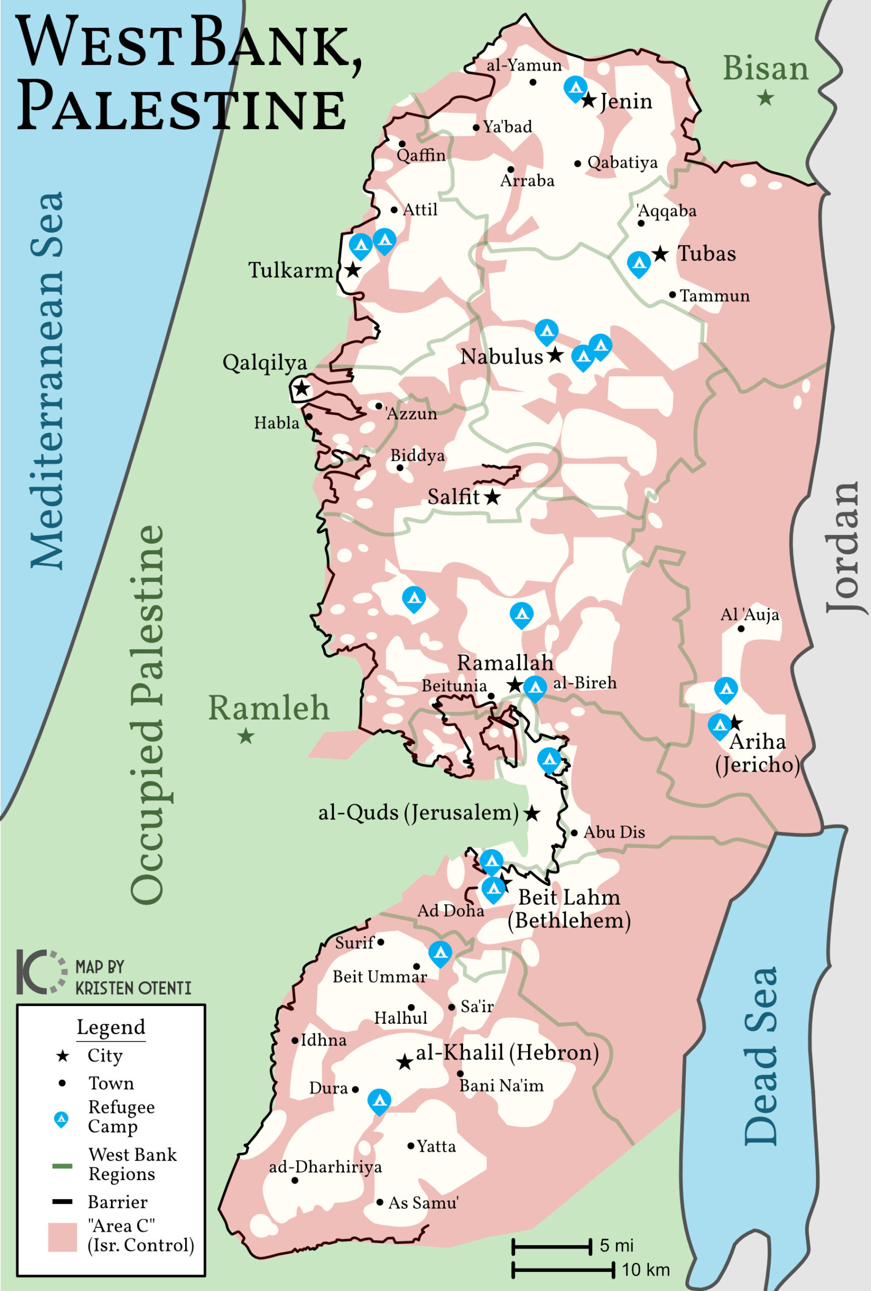
The second Oslo Accord, in 1995, divided the West Bank into three areas with varying Israeli control and occupation.
- Area A: Palestine controls most affairs, including internal security.
- Area B: Palestine controls education, health, and the economy.
- Area C: Controlled and settled by Israel.
On the map above, the white areas comprise Areas A and B, while the red represents Area C. Note that while Palestinians retain internal control of Areas A & B, Israel still has full external control and has decided its military has the right to enter these areas at any time.
While not entirely closed off, like Gaza, you can see there are portions of barriers built along some of the West Bank “border.”
Links to Learn More About Palestine
- Decolonize Palestine, which provides Palestine 101, myth busting, and answers to FAQs.
- A Master List of Resources on Palestine by Twitter user @yafasorange.
- Infographics from Visualizing Palestine (no alt text).
- Current events from Al Jazeera.
- Other news sources include The Electronic Intifada and Middle East Eye.
- And again, I include other links in my blog post, A Timeline Of The Colonization Of Palestine, and the page, Everything I Wish I Could Pin on Twitter.
From the river to the sea, Palestine will be free!